Update May 19, 2021: This article was originally published in July, 2007. We've updated the article to include information about recent advances in volcano monitoring and to reflect current information about the Volcano Hazards Program's budget.
"Vancouver! Vancouver! This is it!" On May 18, 1980, U.S. Geological Survey volcanologist David Johnston had a clear view of Mount St. Helens's north flank from his monitoring station 5.5 miles away. Just seconds after the 30-year-old radioed his final words to colleagues, the snow-capped volcano blew itself spectacularly apart.
The mountain had been tranquil until two months earlier, when an earthquake jolted the sleeping giant to life. Even as state police blocked access roads and evacuated homes within a 10-mile "red zone," throngs of tourists, television crews, rescue officials and geologists descended on the heavily forested region 50 miles north of Portland, Ore. A steady succession of more than 10,000 earthquakes, and hundreds of explosive blasts of steam, signaled the pressure building beneath the volcano's slopes. But by Saturday, May 17, the mountain seemed silent. The Red Cross had recalled its emergency cots, and many of the sightseers, having given up on a grand finale, had already gone home.
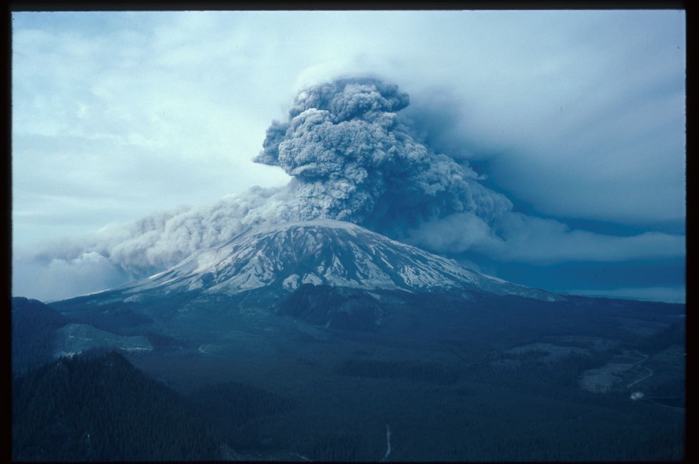
The next morning at 8:32, Mount St. Helens began to tremble. What Johnston then witnessed, as he called in his warning, was the largest landslide in recorded history. A magnitude 5.1 earthquake cut loose the volcano's north flank, which had bulged by 450 ft. A wave of earth and ice rushed down the mountain at 150 mph, pouring into Spirit Lake and coursing 13 miles down the North Fork of the Toutle River — simultaneously scouring it bare and smothering it with as much as 600 ft. of debris. By the time it petered out, the landslide had entombed 24 square miles of forest.
Without a cap of earth to keep it sealed under pressure, Mount St. Helens exploded. Sulfur dioxide gas in the freshly exposed magma, together with compressed water and steam, expanded and blew out the north side of the mountain. This "lateral blast" of ash, magma, rocks and sand reached 100 stories high and spread 10 miles wide as it plowed down valleys and over ridges at speeds near 700 mph.
It was this lateral blast, or surge, as some geologists prefer to call it, which claimed most of the 57 fatalities that day — including Johnston. Neither he nor his trailer was ever found, both presumably hurtled into the next valley and buried in debris.
Most loggers were off for the weekend, but Jim Scymanky and three co-workers were roughly 10 miles away at the time of the blast. "It sounded like a couple of big passenger jetliners coming through the woods," Scymanky said at a Mount St. Helens commemorative event in 2000. "Everything was hot. Trees were smoldering." Scymanky's gloves had melted onto his hands, and the ash left serious burns over nearly half of his body. And then it was gone.
"It was barren. You didn't know where the hell you were," Scymanky told The Oregonian. "One minute you've got landmarks all over. You know where the stream is, where the roads are. [The next second] No roads. No streams. No nothing. I mean, just gone. It was like it picked you up and put you on a different planet." A National Guard helicopter rescued Scymanky and two of his co-workers, Leonty Skorohodoff and Jose Dias, who both later died from their wounds. The body of the fourth logger, Evlanty Sharipoff, was found more than a month later.
A few miles further north, Bruce Nelson and a group of friends were fishing for steelhead trout on the Green River. Nelson's group, however, heard nothing as the surge closed in on them. "People couldn't comprehend it, but the cloud was so dense with sand and debris that it absorbed all the sound," says USGS geologist Richard Waitt.
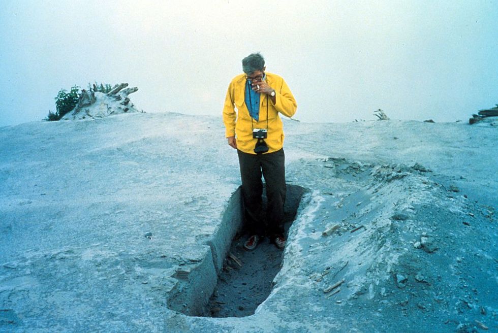
Nelson later explained to The Juneau Empire how he survived. "Two huge trees were uprooted where my girlfriend, Sue Ruff, and I were standing. We fell down into the hole. That actually put us below ground level, so we were kept from being burned severely. Our hair was frizzed, and the hair on our arms was burned off, but we were saved from worse burns."
Nelson and his girlfriend trudged through knee-deep ash for hours until rescuers picked them up. They were among the estimated 125 people who survived in the blast zone, as were two of their friends. A third couple, Terry Crall and Karen Varner, died in their tent as the superheated ash blew through.
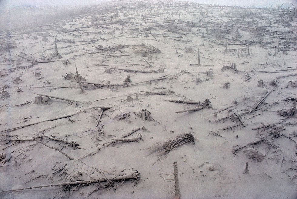
As far as 17 miles from the volcano, the surge flattened thousands of 100-ft. trees, some 6 ft. in diameter, and feathered them atop each other. State officials estimated that 4 billion board feet of timber was knocked over that day — enough to build at least 150,000 homes. Some 7000 elk, deer and bear were killed, along with millions of salmon fingerlings. Fish in rivers near the volcano literally jumped onto shore as the water temperature rocketed to 90 degrees. On the whole, the eruption turned 230 square miles of lush forest that lured 500,000 visitors a year for wilderness recreation into a lunar wasteland.
The lateral blast uncorked Mount St. Helens, opening a vent where, for the next 9 hours, a 3-mile-wide gusher of ash and magma spewed skyward. It reached 63,000 ft. into the stratosphere, twice the height that most commercial airliners fly. A group of climbers near the summit of Mount Adams, 30 miles to the west, reported that ash, pebbles and singed pine cones rained down on them.
The force of the eruption also sucked electric charges upwards from the earth's surface, turning the plume into a volatile lightning storm and igniting a 3000-acre forest fire. Before they hurried down the mountain, the Mount Adams climbing party reported sparks jumping between their climbing axes.
The ash traveled east at 60 mph, and by 9:45 am had turned day into night in Yakima, Wash., dumping 600,000 tons of the fine powder on the city. Two hours later it did the same thing in Spokane. Six thousand miles of Washington's highways, city streets and logging roads were, for a time, impassable; no traffic got in or out of the town of Ritzville for three days. The fine ash clogged air filters and brought cars already on the road sputtering to a halt, stranding thousands of drivers. Regional air traffic was grounded. Up to 6 in. of ash rained down on states as far away as Oklahoma.
Even as the main eruption subsided, a series of mini-disasters ensued. Water and mud began to seep out of the initial landslide and rumble down the North Fork of the Toutle River. "You could see it upstream," said Venus Dergan, who had been camping with her future husband, Ronald Reitan, on the riverbank 38 miles from Mount St. Helens. "It started snapping down the trees like they were toothpicks. The mud flow shot through the trees and it was upon us ... there was no place to run." Dergan and Reitan were swept downstream, but managed to hopscotch across the debris and back to shore.
The mud raised the Toutle 21 ft. above flood stage, destroying 200 homes, then swept into the Cowlitz River and finally into the Columbia. It shrank the Columbia River's 600-ft.-wide, 39-ft.-deep shipping channel to just a third of its size. More than 30 oceangoing freighters were stranded upstream in Portland and in Vancouver, Wash.
Four days after the eruption, President Carter flew over the disaster zone in a helicopter. "Somebody said it looked like a moonscape, but the moon looks like a golf course compared to what is up there," the president said. "It is a horrible-looking sight. There is no way to prepare oneself for the sight we beheld this morning."
The Aftermath
Mount St. Helens caused a staggering $1 billion in damage, and opened Americans' eyes to the dangers of volcanoes on their own soil — in fact, right next to their cities and homes. "There are 169 volcanoes in the U.S. that have erupted in the last 10,000 years," says Jeff Wynn, chief scientist of the USGS volcano hazards program. "That means they could become active again with very little warning."
After the 1980 eruption, Congress funded the USGS Cascades Volcano Observatory to monitor volcanoes in the Cascades range, including Mount St. Helens, Mount Hood and Mount Rainier. In subsequent years, observatories were established for the Long Valley caldera in California, the Yellowstone National Park region and Alaska. Only an observatory in Hawaii predated Mount St. Helens. The budget for monitoring volcanoes went from $2 million in 1980 to over $25 million today.
In many ways, Mount St. Helens represented the dawn of earthquake science in the United States. "I'd say our knowledge has easily doubled," Wynn says. For example, Mount St. Helens's deadly lateral blast had been an unknown facet of volcanic explosions. Since 1980, scientists have catalogued more than 200 volcanoes around the world that have erupted in a similar way.
Technology for better monitoring of volcanoes has advanced dramatically in the last 40 years. In 1980, relatively crude seismometers could only detect high-frequency noises, such as rocks breaking. Today, broadband seismometers the size of a tin of coffee can hear the low-frequency rumblings of fluid moving far below the Earth's surface. Scientists also now employ geochemistry in their predictive efforts, using planes or drones to sniff indicator gases, such as hydrogen fluoride, above restive volcanoes.
Civilian-use GPS technology was in its infancy in 1980, but fixed GPS monitors can measure a volcano's growth and movement in real time today. A bevy of speeding satellites capture these minuscule shifts with incredible precision and accuracy, returning buckets and buckets of data. Researchers are harnessing the power of machine learning, a form of artificial intelligence, to sort through and find patterns in the data. One team is working on projects that use supercomputers to create hundreds of computer models which can forecast the probability of an eruption.
It’s similar to the way meteorologists forecast the weather. Instead of using changes in precipitation or wind speeds within an approaching hurricane to plot the storm’s trajectory, volcanologists input volcanic monitoring data such as ground movement and seismic readings to forecast how rock beneath the volcano may behave.
They’ve tested the technique using data from well-studied eruptions that have already happened—a technique called hindcasting—and are working to implement this method in order to chart future eruptions. Volcanic systems are incredibly complex and each volcano is different. Eventually, the goal is to have a forecast for each volcano constantly running and updating as conditions change.
We can’t predict what our volatile planet will do next, but these advances help us better understand the risks we’re dealing with. That means scientists such as Johnston don't have to risk their lives by continuously putting themselves in close proximity to active volcanoes.

